Template:LocationInfo
| |||||||||
| {{{suburb}}}, ({{{coordinates}}}) | |||||||||
| |||||||||
| Basic Info | |||||||||
| {{{description}}} |
Purpose
This template is to allow basic information per location ("block"), with links to adjacent locations.
Keywords
location: The name of the location.
suburb: The suburb where the location is in. This can be a plain text or a link to the suburb page, latter is preferred for navigation.
coordinates: Location's X and Y coordinates on the map.
X_location: This is to name the location in the associated sector (NW, NE, etc). Location can be written as plain text that won't create a link to a page, or with link as follows:
[[Title]]
The location can also be written with a customized page link, where the first argument is the page and the second the displayed name (preferred to common tiles such as parking lots and wastelands):
[[Wasteland (6,1)|Wasteland]]
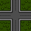
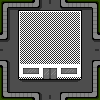
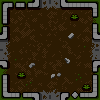
X_tile: The building tile for the associated sector (NW, NE, etc). This looks for tile keywords from Category:Map Tiles. To call for the tile, remove preceding "Template:" when using the page name as a keyword.
description: free-form text field for added information.
How to use
By writing the template as below:
{{LocationInfo
|location=Test Street
|suburb=[[Test Suburbia]]
|coordinates=690,420
|NW_location=[[Border]]
|NW_tile=Border
|N_location=[[Border]]
|N_tile=Border
|NE_location=[[Border]]
|NE_tile=Border
|E_location=[[Border]]
|E_tile=Border
|this_tile=Street
|W_location=Fort Barnes Training Ground
|W_tile=Restaurant
|SW_location=[[Border]]
|SW_tile=Border
|S_location=[[Wasteland (690,421)|Wasteland]]
|S_tile=Wasteland
|SE_location=Vampire Street
|SE_tile=Street
|description=A nondescript street, potholes and litter dotting the asphalt
}}
will create the following box (below right):
| ||||||||||||||||||
| Test Suburbia, (690,420) | ||||||||||||||||||
| ||||||||||||||||||
| Basic Info | ||||||||||||||||||
| A nondescript street, potholes and litter dotting the asphalt |